
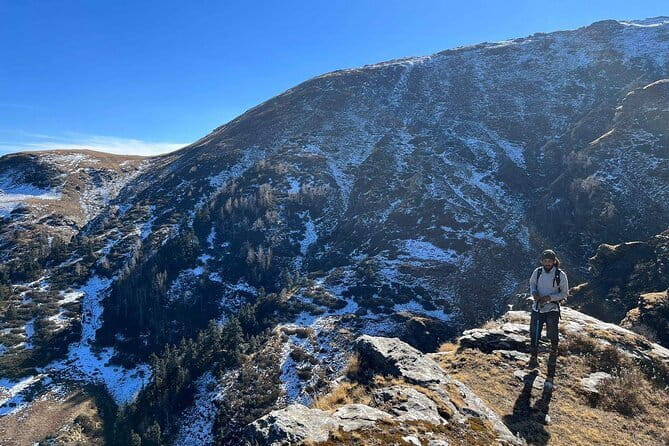
REVIEW · INDIA
7-Day Kuari Pass Trek
Big peaks, quiet villages, and hard walking await. The 7-Day Kuari Pass Trek crosses the Garhwal Himalaya in Himachal Pradesh and Uttarakhand, reaching 4,265 metres beside the outer edge of the Nanda Devi Sanctuary. I like the mix of high meadows and rhododendron forests, and I like that the route passes through real mountain villages rather than keeping you on a single high trail.
The views of Nanda Devi, Dronagiri, Nanda Ghunti, Chaukhamba, and Hathi Ghodi are the main prize. The excellent hospitality, satisfying food, and easy conversation from the Mapping The Himalayas team add warmth to a demanding week. The trade-off is clear: this is not a gentle walking holiday. You need moderate fitness, an early start on summit day, and comfort with steep ground, loose moraine, suspension bridges, and changing weather.
Key points before you book
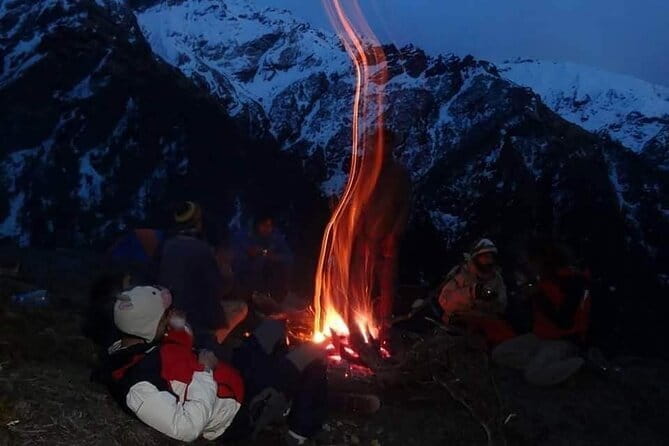
- 4,265-metre Kuari Pass: The high point brings wide views across the Garhwal Himalaya, including Dronagiri and Nanda Devi.
- Village-to-village walking: Ramni, Ghunni, Jhinjhi, Pana, and Auli give the trek a strong local character.
- Gorson Meadow finale: The final walk across this broad meadow offers one of the best views of Nanda Devi.
- Full camping support: Tents, sleeping bags, trekking poles, head torches, ponies, and porters are included.
- Private seven-day format: Only your group takes part, with private transport and pickup offered.
- A demanding route: Steep climbs, false summits, loose moraine, and thin air make preparation important.
What makes the Kuari Pass route special
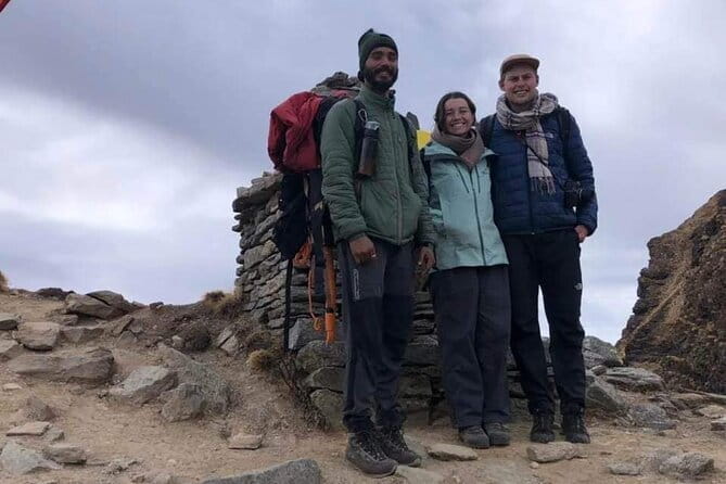
Kuari Pass is not simply a march to a viewpoint. The route links forests, pasture, village paths, river valleys, and open ridges. That variety gives you a better sense of the Garhwal Himalaya than a trek that spends every night at the same altitude.
The pass sits in Chamoli District at about 4,265 metres. Along the way, you skirt the outer wall of the Nanda Devi Sanctuary and cross terrain shaped by some of northern India’s major rivers. The route connects with the world of the Ganges, Alaknanda, Bhagirathi, and Mandakini, although your most immediate river crossing is over the Birahi Ganga.
I especially like the human scale of the first half. Ramni and Ghunni appear from the ridges, Jhinjhi brings you into village life, and Pana gives you a high camp above the settlement. These are not just transfer points. They break up the physical effort and show how people live in the mountains.
The scenery also changes at a useful pace. You begin with roads and river valleys, move through rhododendron woodland, reach open pasture, and finally walk above the tree line. If you enjoy seeing an entire mountain environment unfold over several days, this route earns its reputation.
A few more treks around India worth a look
- 7 Days Dharamsala – Dalai Lama home Trek
★ 4.5 · 8 reviews - Best Kilimanjaro Adventure 7 days Machame route Trekking
★ 5.0 · 42 reviews - Kilimanjaro 7 Day Private Trekking Experience
★ 5.0 · 40 reviews
Day 1: Four river confluences on the road to Ghat
The first day takes you from the morning departure point toward Ghat after a quick breakfast. The road passes Devprayag, Rudraprayag, Karnprayag, and Nandprayag, four well-known meeting points of rivers in the Garhwal Himalaya.
This is a long scenic approach rather than a trekking day. It gives you a useful introduction to the scale of the region, with deep valleys and roads following the river systems. At Rudraprayag, the Mandakini and Alaknanda meet, a place you also pass again on the return drive.
Ghat is a sizable mountain village with schools, government offices, and a market serving nearby settlements. That detail matters. You are not being dropped at an artificial resort built only for trekkers. You spend the first night near a functioning community, which helps set the tone for the days ahead.
The drawback is that the first day may feel slow if you are eager to walk. Still, the road journey is necessary, and the confluences provide a memorable introduction to the geography.
Day 2: From Selu Bagar to Vinayak Pass and Jhinjhi
The walking begins at Selu Bagar, where a few small village shops serve as the last simple roadside stop described for this section. A typical village jeep carries you onward to meet the ponies and porters who support the trek.
The trail climbs toward a ridge with views back to Ramni and Ghunni. Beyond the ridge, an open meadow gives you a first strong look at Nanda Ghunti and Chaukhamba. This is a rewarding start because the route quickly leaves the road and places you among fields, woodland, and mountain settlements.
You then walk through rhododendron forest and pasture grasslands, passing nomadic huts before the gradual climb to Vinayak Pass. A small Ganesha temple marked by prayer flags identifies the pass. From here, you can look toward the Himalaya and Kuari Pass itself.
The descent through Sem Kharak leads to Jhinjhi. The village provides one of the most human parts of the trip, with colorful settlements and a close look at daily mountain life. You should expect a full walking day with plenty of uphill work, but the route is broken by changing views and village scenery.
Day 3: The Birahi Ganga bridge and the climb to Pana
Day three starts among the houses and paths of Jhinjhi. The trail descends through the village to the valley floor, where you cross a high suspension bridge over the Birahi Ganga.
The bridge is an important moment in the route. It is not just a photograph stop. Once you cross, the trail climbs steeply on the other side, first by zigzags and then by a series of false summits. You gain height in stages, so patience helps. The ridge rewards you with views of settlements and Himalayan peaks nearby.
From the ridge, the path becomes more gradual and enters another fine stretch of rhododendron forest. You pass Kaliagad before reaching Pana, then climb for less than a kilometre to the campsite above the village.
This day combines a dramatic river crossing with sustained climbing. If you dislike exposed bridges or steep uphill trails, this is a section to consider carefully. Trekking poles, included with the equipment, should make the ascent and descent easier.
Same trailhead, a longer or shorter day out:
- Half day trekking (munnar valley Trekking & Tours )
★ 5.0 · 310 reviews - Nag Tibba 2 Days Trek (Pantwari to Pantwari)
★ 5.0 · 274 reviews - Bhrigu Lake and Alpine Meadow Trek
★ 5.0 · 121 reviews - Har Ki dun Trek by Himalaya Shelter
★ 5.0 · 102 reviews
Day 4: Sartoli meadow, loose moraine, and Dhakwani
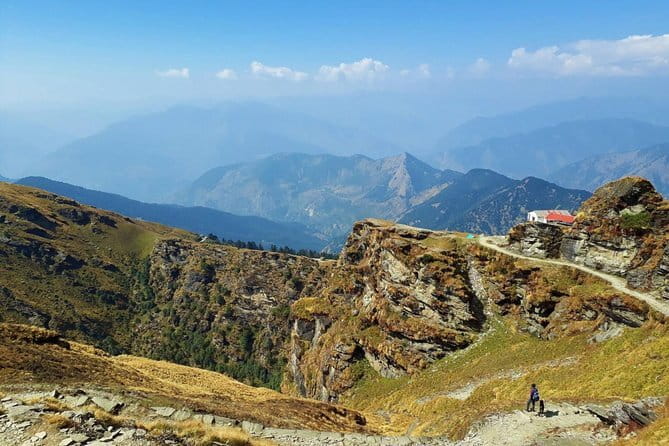
Above camp, a clear trail runs through rhododendron forest. A couple of false summits keep the route from feeling too easy, but the path eventually reaches a ridge and continues toward the open meadow at Sartoli.
Sartoli works as both a camping place and pasture for sheep and cattle. It is also an excellent viewpoint, with Kuari Pass dominating the horizon. I like this kind of stop because it lets you see the next major goal before you reach it. The route becomes easier to understand when you can point toward the pass.
The trail first descends gently for a couple of kilometres. Then the terrain changes. The final descent toward a side stream is steep, and loose moraine makes the footing less secure. Use the supplied trekking poles here, shorten your steps, and give yourself time.
After crossing the side stream, you climb steeply by a series of switchbacks to the ridge. This is one of the more tiring sections of the trek, so the campsite at Dhakwani should feel well earned. The day offers excellent scenery, but the loose rock and repeated climbing make it less suitable for anyone seeking an easy mountain walk.
Day 5: The main prize at 4,265 metres
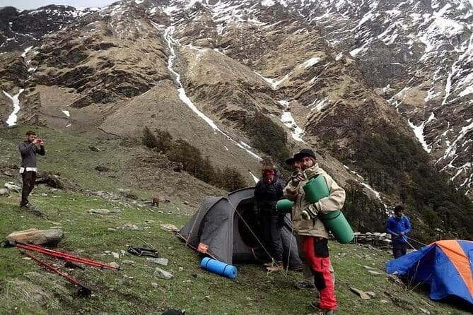
Day five begins early. That is sensible, not ceremonial. An early start gives you time to reach Kuari Pass, enjoy the views, and continue toward the next camp without turning the day into a rushed race.
From Dhakwani, the path climbs through forest until you cross the tree line. Above the trees, the trail traverses to the left side of the valley beneath the pass. A series of switchbacks then takes you directly to Kuari Pass.
This is the visual high point of the trek. From the pass, you can take in broad Himalayan views and spend time with your camera. Nanda Devi, Dronagiri, Nanda Ghunti, Chaukhamba, and Hathi Ghodi are among the named peaks associated with the route. Weather can control how much you see, so patience and realistic expectations are wise.
The path climbs slightly from the pass to a hump, where Dronagiri comes into view. It then descends to a fork for Tapovan and Tali, with the route continuing toward Tali along a ridge marked by a temple.
This is a demanding day because the altitude and early start add to the physical effort. The reward is not one isolated lookout, but a long sequence of ridges and peaks. You should not book this section expecting a quick walk up and down.
Day 6: Gorson Meadow and the road to Joshimath
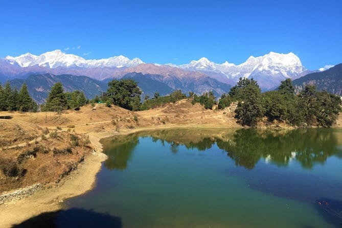
The sixth morning is described as a more relaxed start. From Tali, the trail climbs gradually along a mountain ridge. The path is narrow in places, so you need to watch your footing even though the gradient is not extreme.
The route reaches Gorson Meadow, one of the most enjoyable walking sections of the trip. Here, the surroundings open out and the Himalaya appear all around you. Nanda Devi is the dominant peak, and crossing the meadow gives you a pleasant change after the tighter paths and forest sections.
The concrete structures of Auli eventually appear in the distance. This is a clear sign that the camping part of the journey is ending. At Auli, you say goodbye to the ponies and porters, then take a jeep for the 13-kilometre drive to Joshimath.
Joshimath is a busy market town serving nearby villages. It feels practical rather than polished, which is exactly what you want after several days in remote country. The town gives you a useful contrast with the camps and villages behind you.
Day 7: Returning to Rishikesh through Rudraprayag
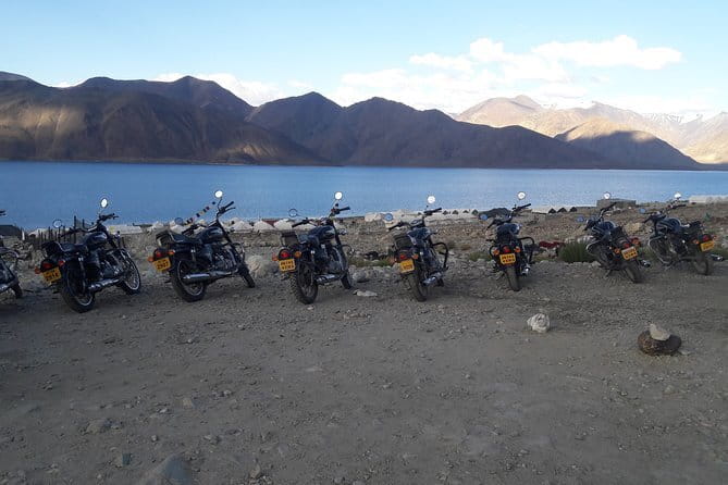
The final day begins with an early drive to Rishikesh. You pass through Rudraprayag, where the Mandakini and Alaknanda meet, and stop for lunch along the way before arriving in Rishikesh by evening.
This is another long road day, so do not treat it as spare sightseeing time. Its value is the gradual return from high mountain valleys to the lower river corridors. The stop at Rudraprayag adds one last geographical marker to a trip built around rivers and mountain routes.
What is included, and what the price means
The price is $1,188.21 per person. That is a substantial amount, but it covers much more than guiding. You receive private transportation, all fees and taxes, trekking tents, sleeping bags, trekking poles, head torches, ponies, porters, breakfast for seven days, lunch for seven days, and dinner for six days.
That package makes the price easier to judge. A supported Himalayan trek requires transport between scattered trailheads, camping equipment, food, and a working team to move supplies. You are not paying only for access to a pass. You are paying for a private operation that carries the practical burden of a remote route.
The food is a real part of the value. Strong meals matter after steep days, and the warm hospitality associated with the Mapping The Himalayas team adds to the experience. The positive feedback particularly highlights delicious food, kind service, playful conversation, and a feeling of being well cared for.
Insurance is not included. Arrange your own cover before departure, and check that it applies to trekking at the altitudes involved. That is not a minor detail.
Fitness, equipment, and weather
You need a moderate level of physical fitness. The route includes steep switchbacks, false summits, long descents, a suspension bridge, narrow trail, loose moraine, and a high pass at 4,265 metres.
The included trekking poles are especially useful on the steep moraine section near the side stream. A head torch is also supplied, which matters because day five starts early. Sleeping bags and tents reduce the amount of specialist camping equipment you need to bring yourself.
Good weather is required. If poor weather forces cancellation, you are offered another date or a full refund. The cancellation terms allow a full refund if you cancel at least three full days before the start time. Changes or cancellations inside that window are not accepted, and the amount paid is not refunded.
The experience is private, so only your group takes part. That can make the pace and atmosphere more personal, but it also means your group must be ready for the route’s physical demands rather than relying on a large crowd to spread the effort.
Who should book this trek
I would choose this trek if you want a serious mountain route with village contact, camping, high meadows, and major Himalayan views. It suits people who value the journey between viewpoints, not just the photograph at the pass.
It is also a strong choice if you prefer a private trip and want transport, food, porters, ponies, and camping gear arranged together. The team’s hospitality is an important part of the appeal, especially if you enjoy sharing meals and conversation after a hard day.
I would hesitate if you want a soft adventure, a fixed hotel bed each night, or a short walk with minimal climbing. The route has several physically demanding sections, and poor weather can affect the experience. Insurance is your responsibility, and the high altitude should be taken seriously.
Should you book the Kuari Pass Trek?
Book it if you want a demanding but well-supported week in the Garhwal Himalaya. The best reasons are the varied route, the open views from Kuari Pass and Gorson Meadow, the village sections, and the amount of equipment and transport included.
Before paying, make sure your group is comfortable with steep trails and camping. Also confirm the meeting point and pickup details, since the available information notes that pickup is offered but does not specify every pickup location. If your fitness is suitable and the weather works in your favor, this trip offers a rare balance of big peaks, local communities, and genuine mountain walking.
FAQ
How long is the Kuari Pass Trek?
The experience lasts approximately seven days.
Where does the trek take place?
The route runs through Himachal Pradesh and Uttarakhand, including the Garhwal Himalaya and Chamoli District.
How high is Kuari Pass?
Kuari Pass is situated at approximately 4,265 metres.
Is transportation included?
Yes. Private transportation is included, including the jeep transfer from Auli to Joshimath and the road journey to Rishikesh.
Are tents and camping equipment provided?
Yes. Trekking tents, sleeping bags, trekking poles, and head torches are included.
Are meals included?
Yes. Breakfast is included for seven days, lunch for seven days, and dinner for six days.
Is this a private tour?
Yes. Only your group participates in the activity.
Is insurance included?
No. Insurance is not included in the price.
How fit do I need to be?
You should have a moderate level of physical fitness. The route includes steep climbs, steep descents, false summits, narrow paths, loose moraine, and a high-altitude pass.
What happens if bad weather cancels the trek?
If poor weather causes cancellation, you are offered a different date or a full refund.
Recently added around India
- Prashar Lake Trek★ 5.0 · 7 reviews
- Kasol + Kheerganga Trek 3D/2N, all inclusive with BanBanjara★ 3.5 · 3 reviews
- Jogini Waterfall Trek from Manali★ 5.0 · 2 reviews
- 8 Days Markha Valley Trek: Shared Tour with Meals Included★ 5.0 · 3 reviews
- Ladakh One Day Trek- Gyamtsa to Phyang Village★ 5.0 · 4 reviews
- Ladakh Sham Valley Trek★ 5.0 · 7 reviews
- 1 Day Activity Adventure Trekking Kerala★ 5.0 · 5 reviews
- Kolukkumalai Trekking with Night stay in Tent★ 5.0 · 2 reviews
7-Day Experiences, compared.
Best Kilimanjaro Adventure 7 days Machame route Trekking
Read our review →
7-Day: Inca Trail Trek to Machu Picchu Group Tour
Read our review →
Kilimanjaro 7 Day Private Trekking Experience
Read our review →
Wonderful 7 Days North Sumatra Tour (Include: 2 Days 1 Night Jungle Trekking)
Read our review →
Kilimanjaro Trekking 7Days 6Night Lemosho Route
Read our review →
Browse the lists this tour appears in