
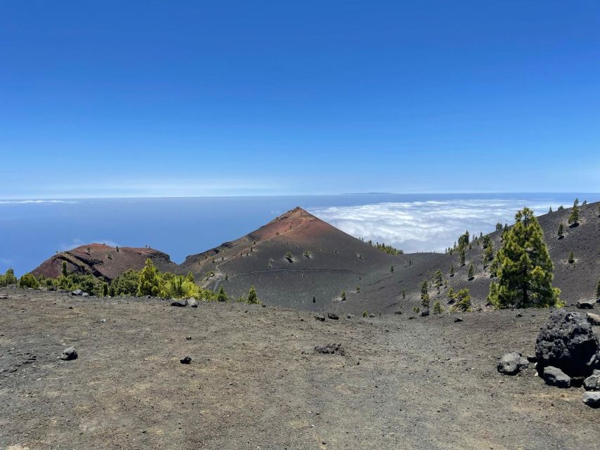
REVIEW · SPAIN
La Palma: Guided trekking tour to volcanoes south
Volcanoes make fine hiking companions. This 17-kilometre route crosses La Palma’s young volcanic country from El Pilar Refuge to Los Canarios, with pine woods, black ash, red craters, and wide island views. I like the mix of natural drama and useful geology, and I like that hotel transfers are included. The main catch is simple: this is a tough, full-day walk, not a casual stroll.
I also like the small-group option and the chance to walk with a guide in Spanish, English, or German. Guide Arnie has been singled out for excellent organization and clear information about La Palma’s volcanic activity. Bring your own food and drinks, though, since neither is included.
Key points to know before you book
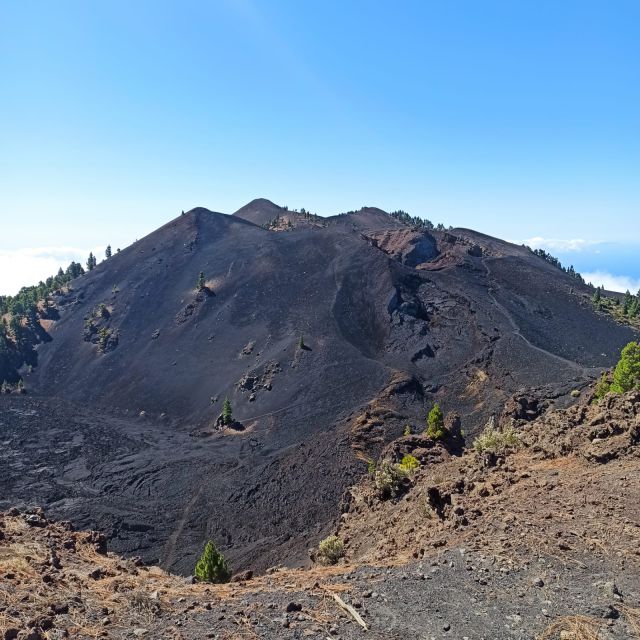
- 17 kilometres from El Pilar to Los Canarios: The route crosses much of the Cumbre Vieja Natural Park and takes about eight hours.
- Volcanic scenery changes all day: Expect pine forest, ash fields, calderas, lava, sharp cones, and red volcanic rock.
- A demanding route with a major descent: You climb early, reach the high point near Las Deseadas, then descend toward Fuencaliente.
- Big views on clear days: You may see the Aridane Valley, Caldera de Taburiente, Roque de Los Muchachos, and neighboring Canary Islands.
- Transport is part of the deal: Hotel pickup and drop-off save you from solving the one-way trail problem yourself.
- Good value at $50: The price includes the guide and transfers, but not lunch, drinks, or snacks.
Why the Volcanoes Route is La Palma’s signature hike
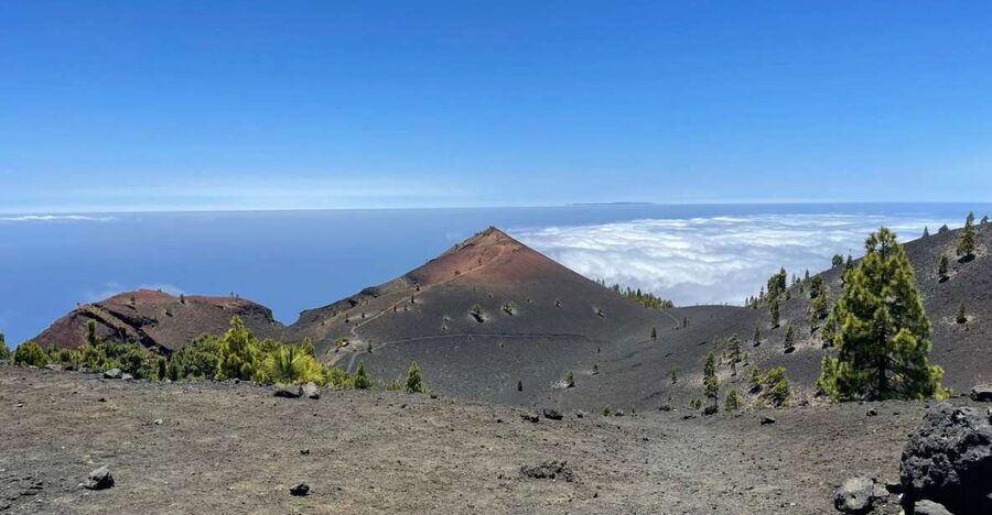
La Palma is often called the Isla Bonita, and this route shows why. You move through several versions of the island in one long day: dark pine woods, open ridges, gray ash, red cinder, and craters shaped by eruptions.
The route follows the GR-131 trail through the Cumbre Vieja Natural Park. This is the younger volcanic spine of La Palma, where the ground still tells a clear story of fire, pressure, and collapse. Your guide helps turn what might look like a series of black hills into a readable record of the island’s formation.
The Mars comparison is not just marketing fluff. In places, the vegetation disappears and the ground becomes a field of ash and volcanic rock. Red cones and dark slopes create a strange, dry setting that feels far removed from the green Canary Island pine forest nearby.
I especially like the contrast. You are not walking through one unchanging volcanic zone. The colors and textures keep shifting, which makes the 17 kilometres feel more varied than the distance suggests.
Still, do not underestimate the route. Eight hours on volcanic ground is hard work. The trail includes an uphill section near the start and a long descent later in the day. Loose ash can make footing tiring, and the route requires good physical condition.
More Volcano Treks in Spain:
- La Palma: Tajogaite Volcano Guided Trek
★ 4.8 · 1,810 reviews - Volcano Trekking Tour (Timanfaya eruptions)
★ 5.0 · 339 reviews - Trekking in the Volcanoes Natural Park in a small group
★ 5.0 · 97 reviews
Starting at El Pilar Refuge near the pine forest
The hike begins at El Pilar Refuge, a high starting point in the mountain range. From here, the GR-131 climbs toward the area around Pico Birigoyo.
The first section introduces the island’s green side. Canary Island pines line parts of the trail, while openings in the trees give you views toward the Aridane Valley, Caldera de Taburiente, and Roque de Los Muchachos. Roque de Los Muchachos is La Palma’s highest point, so seeing it from this route helps you understand the island’s steep internal relief.
This early climb is a useful warning about the day ahead. You gain height from the start, and the effort comes before the most dramatic volcanic scenery. Pace yourself here. A fast first hour could make the later descent feel much longer.
The route also looks toward El Paso, Los Llanos de Aridane, and Tazacorte. On a clear day, these views show how quickly La Palma falls from mountain ridge to coast. The island may look compact on a map, but its valleys and slopes create a much larger sense of space.
Clouds can add another layer to the experience. Around the higher parts of the route, a blanket of cloud may gather below the ridge, looking like a white sea. It can hide distant views, but it also gives the trail a dramatic change in mood.
Hoyo Negro and the start of the crater country
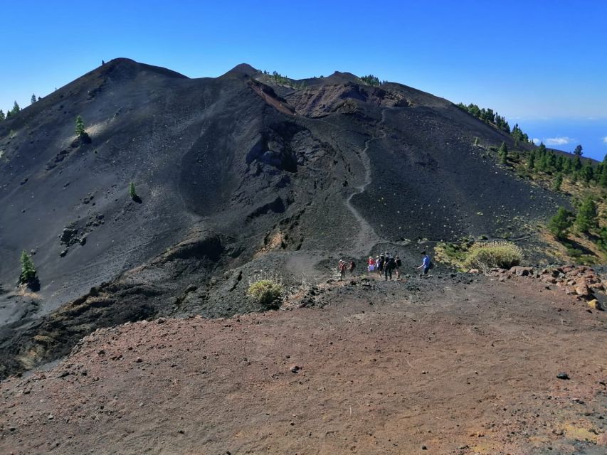
As you continue through the pines and higher ground, the volcanic character becomes stronger. Hoyo Negro marks the start of the crater section, with more open ground and clearer signs of past eruptions.
This is one of the places where a guide adds real value. Volcanic cones can look similar when you see several in a row. A guide can connect the craters, ash, lava, and calderas to the island’s geological story, so you are not simply walking past attractive piles of rock.
Hoyo Negro can also provide wide views across La Palma. Depending on the weather, you may see Santa Cruz de La Palma, Los Cancajos, and other parts of the island. On especially clear days, the neighboring islands of Tenerife, La Gomera, and El Hierro may appear.
The word may matters here. Mountain weather changes quickly, and cloud can cover the views. You should book this for the volcanic route itself, not only for the promise of distant islands.
From this point, the trail feels more exposed and more rugged. The greenery remains part of the picture, but the ash and open slopes begin to dominate. This is the section that best fits the Mars comparison, especially when the light picks out the red, brown, and black volcanic surfaces.
Las Deseadas, the high point of the walk
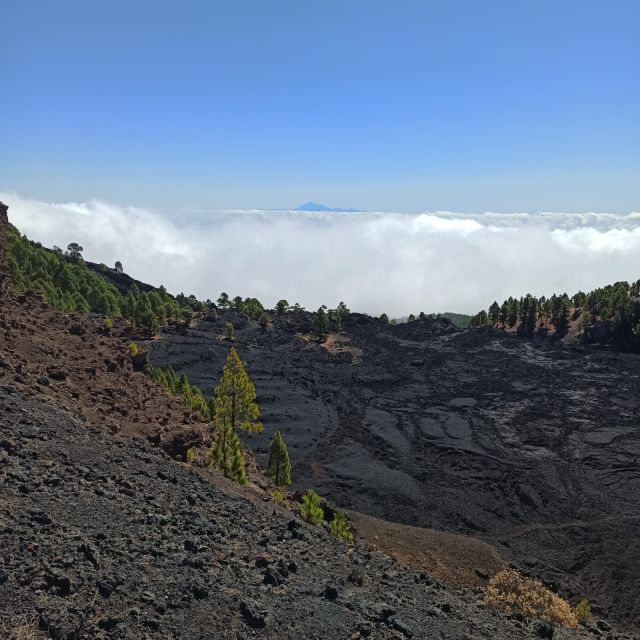
The route continues toward Las Deseadas, the highest point of the day. Reaching this section gives you a strong sense of crossing the volcanic backbone of La Palma.
The high ridge is valuable for more than altitude. It lets you look across both sides of the island, often with the sea visible beyond the slopes. The view changes as you walk, so you are not limited to one lookout or one photo stop.
This is a good place to take pictures, but do not let the camera slow you too much. You still have a substantial distance ahead, and the character of the walk changes after Las Deseadas.
The climb can be demanding, particularly if the day is warm or the air is thin at higher elevations. The tour description calls the route tough, and that warning deserves attention. You need to be comfortable walking for many hours, handling uneven ground, and continuing after the main viewpoint.
Small groups can help here. A guide can keep the pace organized and explain what you are seeing without the stop-and-start feel of a large outing. The language options are Spanish, English, and German, so check that your preferred language is available when booking.
More Guided Treks in Spain:
- Caminito del Rey: Trekking Tour with Hiking Guide
★ 4.1 · 295 reviews - Fuerteventura: Guided Trekking Tour with Island Goats
★ 4.9 · 146 reviews - La Palma: Guided Trekking Tour to El Roque de los Muchachos
★ 4.6 · 104 reviews - La Palma: Guided Trekking Tour To Cubo de la Galga
★ 4.4 · 90 reviews
The long descent toward Volcán de Martín
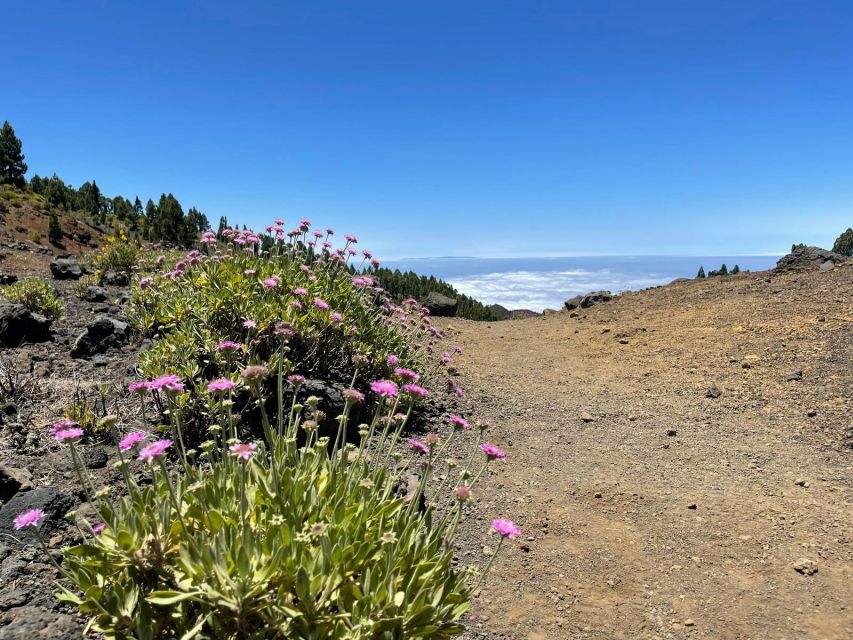
After Las Deseadas, the route begins to descend. Many hikers find downhill walking harder than climbing, especially on loose volcanic ground. Your knees and feet take more punishment, so sturdy footwear and a controlled pace matter.
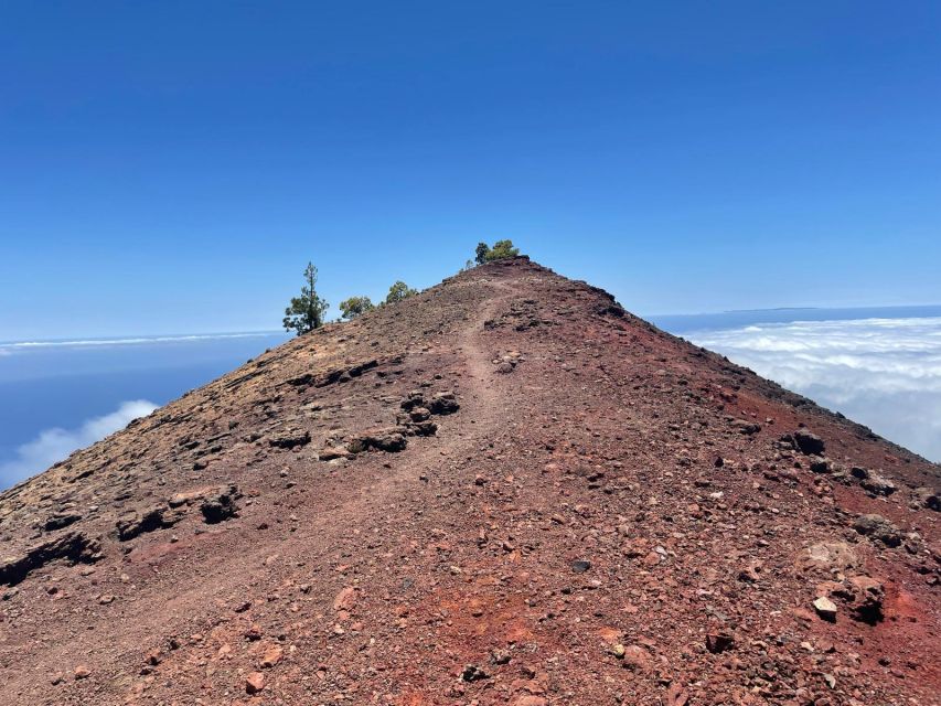
The descent leads toward Volcán de Martín, one of the last major craters before Los Canarios. Its reddish cone is easy to notice from a distance. The color gives it a different character from the darker ash slopes and green pine sections earlier in the walk.
Volcán de Martín is a strong final volcanic landmark, but it does not mean the day is over. You still need to continue down to Los Canarios in Fuencaliente. Keep some energy in reserve rather than treating the crater as the finish line.
This part of the route can feel more remote and stark. The forest has largely given way to volcanic ground, and the southern end of La Palma feels dry compared with the greener northern and central areas. You get a clear impression of how eruptions have extended and reshaped the island.
The scenery is excellent, but the descent is the main physical drawback of the route. If you have weak knees, limited hiking experience, or trouble walking on loose surfaces, this is the section to consider carefully.
Finishing in Los Canarios and returning by transfer
The guided walk ends at Los Canarios, in the municipality of Fuencaliente. This one-way finish is one of the practical strengths of the tour. You do not need to retrace 17 kilometres, arrange a second car, or work out how to return to El Pilar by public transport.
A transfer takes you back to the starting area or your hotel, depending on the option booked. Pickup and drop-off are included, although the exact meeting point can vary. Confirm the arrangements before the day of the hike.
The transport also adds value to the $50 price. You are paying for a full-day guided walk plus the problem-solving that comes with a one-way mountain route. You still need to buy food and drinks, but the included transfer makes this more than a basic trail outing.
The eight-hour duration includes the walking program and the day’s transport arrangements, so starting times can vary. Check availability for the exact departure time and allow yourself enough time for pickup.
What to bring for an eight-hour volcanic hike
Food and drinks are not included, so carry enough for a full day. There are no promised meal stops in the information provided, and you should not assume that supplies will be available along the route.
Wear hiking shoes with a firm grip. Volcanic ash and uneven rock are much less forgiving than a smooth paved trail. The long descent also makes good support important.
A few practical priorities:
- Bring plenty of water and a packed meal.
- Carry snacks for the climb and the later descent.
- Wear layers because conditions can shift between pine forest, cloud, and exposed ridge.
- Pack sun protection even if the morning begins under cloud.
- Keep room for a camera, but do not carry more than you need.
These are sensible preparations for the route’s length and terrain, not added luxuries. The scenery encourages frequent photo stops, but the physical effort remains real.
How good is the guide service?
The guide is central to this experience. Without interpretation, you would still see beautiful craters, but you would miss much of the meaning behind the ash fields, cones, lava, and calderas.
The strongest feedback has focused on two things: good transport arrangements and useful information about volcanic activity. The named guide Arnie has been praised for both his guiding and the way the day was organized. That matters on a point-to-point route, where a late pickup or unclear meeting place would create unnecessary stress.
The tour is available with a live guide in Spanish, English, or German. A small group is also available. I would choose the smallest option offered if you want to ask questions, walk at a more personal pace, and hear the explanations clearly.
The guide cannot remove the physical challenge. This is still a 17-kilometre route with climbing and a difficult descent. What the guide does is make the effort more rewarding and the logistics simpler.
Is $50 a fair price?
At $50 per person, this is a strong value for a full-day experience. The price includes hotel pickup and drop-off plus a live guide, which are the two costly and useful parts of a one-way mountain hike.
You are not paying for food or drinks, so budget for those separately. Still, the included transport is important. Without it, you might need to arrange a taxi, rental car, or second driver to connect El Pilar with Los Canarios.
The value is best for people who want a structured day and do not want to plan the route alone. If you already have a car, know the trail well, and prefer walking without a guide, a self-guided hike may cost less. You would also lose the volcanic explanation and the convenience of door-to-door transport.
The high rating of 4.9 from 44 reviews supports the idea that the combination of scenery, guiding, and transport works well. The most praised qualities are the organization, the guide, and the volcanic information, rather than food or comfort. That matches what this tour is designed to provide.
Who should book this hike?
You should consider this tour if you enjoy demanding day hikes, volcanic geology, wide mountain views, and changing scenery. It suits people who want to see La Palma’s southern volcanic range in one continuous walk.
It is also a good fit if you are staying on the island without a convenient way to handle a point-to-point route. Pickup and drop-off remove a major planning problem.
You should think twice if you want a gentle outing, dislike long descents, or prefer frequent facilities and meals arranged for you. The tour does not include food or drinks, and the route requires good physical condition.
Families with strong hiking experience may manage it, but the available information does not provide a minimum age or child suitability details. Ask the provider directly if that affects your plans.
Should you book the Volcanoes Route?
Book it if you want La Palma’s most volcanic scenery in one serious day. The route gives you pine forest, high ridges, ash, craters, red cones, and possible views toward several other islands. The guide adds useful context, while the included transfer makes the one-way walk practical.
Skip it if you are looking for an easy introduction to hiking or if 17 kilometres feels beyond your comfortable limit. The trail’s beauty does not make the climb and descent disappear.
For prepared hikers, the $50 price is convincing. Pack your own lunch, water, and snacks, choose a small group if available, and save your camera battery for the craters around Hoyo Negro, Las Deseadas, and Volcán de Martín.
FAQ
How long is the Volcanoes Route hike?
The route is about 17 kilometres long and the activity lasts around eight hours.
Where does the hike begin?
The walk begins at the El Pilar Refuge and follows the GR-131 trail through the Cumbre Vieja Natural Park.
Where does the hike finish?
The guided walk finishes at Los Canarios, in Fuencaliente, the southernmost municipality on La Palma.
Is hotel transportation included?
Yes. Hotel pickup and drop-off are included, although the exact meeting point may vary depending on the option booked.
Are food and drinks included?
No. You need to bring or purchase your own food and drinks for the day.
What languages are available for the guide?
The live guide is available in Spanish, English, and German.
Recently added around Spain
- Trekking Torrent de Pareis★ 5.0 · 15 reviews
- Caminito del Rey Trekking Walkway★ 4.0 · 100 reviews
- Rent a Trekking bike: Full Day 24 hours★ 5.0 · 34 reviews
- Timanfaya National Park Trekking with a Typical Canarian Snack★ 4.5 · 13 reviews
- North Volcano Trekking Tour★ 5.0 · 15 reviews
- Hiking and Trekking Barcelona★ 5.0 · 5 reviews
- Mallorca: Torrent de Pareis trekking Adventure★ 5.0 · 3 reviews
- La Palma: Guided e-bike tour (trekking)★ 5.0 · 6 reviews
Volcano Treks, compared.
summit craters trekking with volcano guide 3350mt
Read our review →
Mount Etna Trekking Tour Beyond the Tourist Trails
Read our review →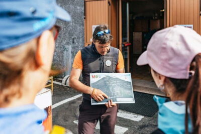
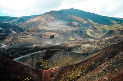
Etna Sunset Tour: Volcano trek, Cave & tasting from Catania
Read our review →
Browse the lists this tour appears in